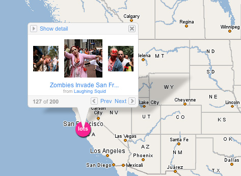
If All the phone can be connected to the GPS, it is not difficult to track the existence of mobile phone owners. Even with technology Geocoded Photograph, images from the camera can show the location of the image.
In the world of web, Tag is a keyword, the search function to facilitate the data in a group category. Tagging concept, is now also reaching the digital mapping technology and mobile photography, a new concept where the cellular phone camera (nokia) The location can be known.
As well as technical metadata, which we will know when the image is made, using what the camera, and on the location coordinates to know how the image is created. About the location of the image, a metadata will describe the coordinates of the photographer stood. If the number of cases associated with the photography porn, of course we will easily find out the location of the making of the image and can immediately track the perpetrators.

Back to the beginning of the discussion, Location Tagger is introduced by Nokia has the advantages of each of the image, always accompanied by the location coordinates.
Nokia Location Tagger is a small application that runs on symbian 3rd . that allows you to perform on the Tagging of pictures taken through cellular phone camera, of course using the geographic coordinates through the use of GPS satellites.
Principally, information is based on the EXIF metada, of course you must be connected to the GPS first. For the owners of the N95 will not be a problem because there are already in the N95 Internal GPS.
In order to get the location tagger application, we need to download here
. Quite a small file that is about 40KB
How to Use.
When running Nokia Location Tagger application, on the main menu, you will see the status of the GPS module. If still not sure, you should go to Menu Maps and try to moment tracking. Make sure the module works properly. After the GPS module is active, it will show your position koodinat stand. If not appear, then wait some time to finish searching.
GPS triangulation method using the GPS 3 satellites belonging to the United States which is located on top of the sky where you stand.
To make a picture Tagging using the Internal camera, just click the camera button, and you can see the icon in the Location Tagger top left corner that indicates the application is running well.
Following indications that indicate the status of your GPS module:
* Green: GPS module is active.
* Yellow brown: Nokia Location Tagger is trying to connect with the GPS, or GPS coordinates search ..
* Red: GPS module is not active.
After the application can read the coordinates, then use the photographs of objects around you. Menu settings or the settings can be adjusted to the needs. For example Tagging -> On Display and Notification-> On
In the Auto Start menu -> Off, On selection determines if the application will automatically open when the camera menu.
Mode of determining the GPS time can be set out in option 5 minutes, while searching for the satellite, the GPS module takes approximately 2-3 minutes. Nokia Location Tagger tries Tagging photos is 10 minutes long, should enable camera first, then activate this application. So that the multitasking, Nokia location tagger application will run in front of the camera while ensuring active GPS module.
Not all images on Tagging, means that if you take photos with a camera can be connected without first module with the GPS and Nokia Location Tagger, the results of the camera you will not be tagged.
The accuracy of the location shooting accuracy also depends on the availability of GPS signals. May arise when the effect of "confused", then the determination of the location of this location will also fail. The effect can mean confusion, the map pointer while you hold still while doing calculations to determine the current trend is on the location where?.
Synchronization with the Flickr account.
With the image that have been tagged in, so you can share to the social network sites, such as Share Online 3.0, Flickr, Panoramio and Picasa Web, so that colleagues or visitors to social networking accounts belong to you. Especially for owners picasa account, panoramio, you combine with google earth. So when you open google earth, we can see the location map in google earth in accordance with the location where the photo.
Compatibility:
* Photos of the camera for Video call can not be in Tagging, for the Nokia Location Tagger can only be used when we use the main camera.
* In some cases, the Nokia Location Tagger may not be able to image and Tagging along with a warning notification message that reads "File is being used".
* Photos of the object with the burst mode will not be on the list ditampilan Logs.
* If the phone does not have internal GPS, the GPS module can use a series Ekternal Nokia LD-4W
* Walking with both the Nokia N95, N95 8GB, N82, E90, N73, N81


0 comments
Post a Comment